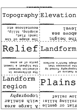
These printable flash cards cover the different topographical features of the Earth.
There are 20 flash cards in this set (4 pages to print.)
To use:
1. Print out the cards.
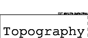
2. Cut along the dashed lines.
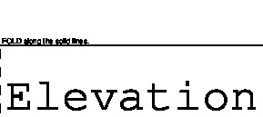
3. Fold along the solid lines.

Sample flash cards in this set:

| Questions | Answers |
|---|---|
| Topography | The shape of the land: Flat, sloping, hilly, mountainous etc |
| Elevation | The height above sea level |
| Relief | The difference in elevation between the highest & lowest parts of an area |
| Landform | A feature of topography formed by the processes that shape Earth's surface |
| Landform region | A large area with similar topography |
| Plains | Flat or gentle rolling hills: low relief |
| Mountains | High elevation with high relief |
| Plateaus | High elevation with flat area on top |
| Lithosphere | Earth's solid, rocky outer layer |
| Atmosphere | gasses around the planet |
| Hydrosphere | Oceans, lakes, rivers & ice |
| Biosphere | Where earth's life exists |
| Longitude | Imaginary lines around the earth |
| Latitude | Imaginary lines from pole to pole |
| Prime Meridian | Imaginary line half way between equator and the pole |
| Scale | Tells the distance on a map compared to the real distance |
| Contour Lines | Lines that show areas of elevation |
| Index Contour | A darker line that has the elevation written on it (every 5th line) |
| Contour Interval | The distance in feet from 1 contour interval to the next |
| GPS Global Positioning System | Using satellites to find latitude and longitude |